 vesseltracker.com
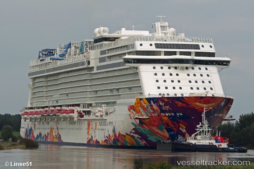
Vessel AROYA IMO: 9733117, MMSI: 249010000 Passenger
UTC, 24.28812, 52.64011, course: 326, speed: 0
UTC, 24.60026, 52.70003, course: 3, speed: 15.8
2026-02-27 16:16:48 UTC, 24.88632, 52.97478, course: 27, speed: 15.3
Live AIS position:
UTC. Near Zirku Island),
updated 2026-02-27 16:16:48 UTC.
Find the position of the vessel AROYA on the map. The latter are known coordinates and path.
marine traffic ship tracker show on live map
The current position of vessel AROYA is 24.88632 lat / 52.97478 lng. Updated: 2026-02-27 16:16:48 UTCCurrently sailing under the flag of Malta
Details:
Last coordinates of the vessel:
UTC, 24.28812, 52.64011, course: 326, speed: 0UTC, 24.28812, 52.64011, course: 326, speed: 0
UTC, 24.60026, 52.70003, course: 3, speed: 15.8
2026-02-27 16:16:48 UTC, 24.88632, 52.97478, course: 27, speed: 15.3